Navigation
- Home Page
- Branford Twitter
- Live Scanner Feed
- WebCam
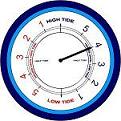
- Tide Chart
- Northeast Buoy Map
-
- GRLevel3 Radar
- National Radar
- NWS Ridge Radar
- NWS Ridge Animated Composite Radar
-
- NWS/Local Forecast
- NWS Forecast
- WXSIM Forecast
- Local WXSIM Graphical Forecast
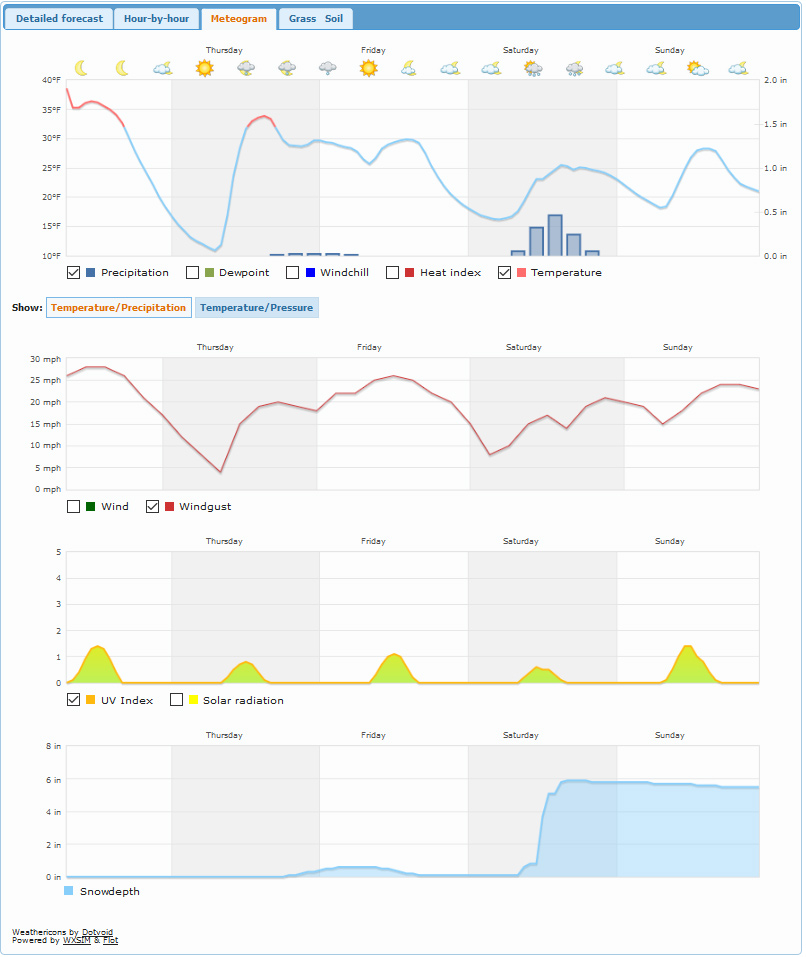
- Multiple WXSIM Graphs
- UV Forecast
- Air Quality
- Allery Data
- Local Live and Extended Forecast
- CT Forecast Discussion
- MLB Forecast
- Fire Weather Discussion
- Marine Forecast
- Tropical Update
-
- Advisory Summary
- Detailed Advisories/Warnings
- Hazardous Weather Outlook
- Connecticut School Closings
- Clickable Area Advisories/Watches/Warnings
-
- Station Highs/Lows
- Weather Trends
- Current Month Report
- Sun/Moon Data
- Wx Underground Hx
- Station Records
- Station Graphs
- Storm Reports
- Local Weather History
- Monthly History
- Temperature History
- USA Weather Extremes
-
- Temperature Trends
- Rain Trends
- CT Metars
-
- NEWN
- NAWN
-
- Weather Logos
- Build a Web Site
-
- Our System
- Contact Us
- Site Map
- Site Status
- Who is Online?
- River Status
- News/Weather Blog
- US Earthquake Map
- Cell Phone Weather
- iPhone Weather
Popular Links
- NWS
- Wunderground
- Weather-Watch
- American Wx Forum
Mobile Phone
-
Get Branford Weather on your SmartPhone

Scan Me With Your Phone's Bar Code Reader App
Follow us on....
![]()
![]()
![]()
![]()

Current Forecast and Live Conditions - Not updated
|
WebCam Image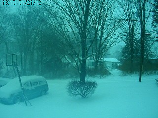
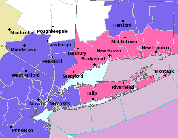
Radar Image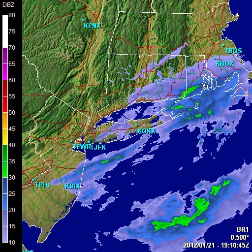 Animated RadarClick Map for Severe Wx Summary!
|
|||||||||||||||||||||||||||||||||||||||||||||||||||||||||||||||||||||||||||||||||||||||||||||||||||||||||||||||||||||||||||||||||||||||||||||||||||||||||||||||||||||||||||||||||||||||||||||||||||||||||||||||||||||||


A cold front moves east of the region this morning...then high pressure builds through the region through thursday. A cold front moves through thursday night...with high pressure building in friday. Multiple low pressure systems will impact the region over the weekend into early next week. ... This discussion continues here
TODAY IN WX HISTORY
|